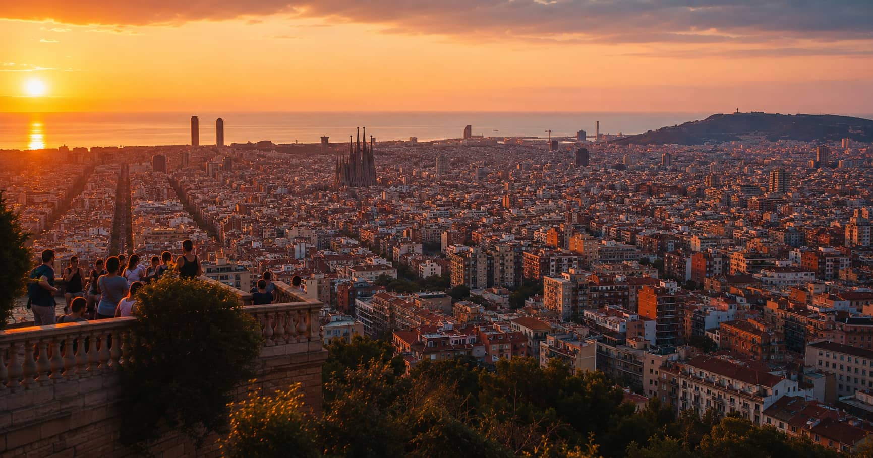
Best Barcelona Sunset Viewpoints
A comparison of Barcelona sunset viewpoints, covering skyline direction, sea views, walking effort, public access, and likely crowd levels.
A comparison of Barcelona sunset viewpoints, covering skyline direction, sea views, walking effort, public access, and likely crowd levels.
Barcelona has many high places, but they do not all face the same direction or show the same city. Montjuïc explains the port and coastline. The hills of Carmel and Collserola reveal the urban grid with the sea behind it. Rooftops and towers provide central views, but access, tickets, and closing times make them less flexible. A useful sunset plan starts with the subject you want, then chooses a viewpoint that keeps the return route simple after dark.
The sun sets west of the city, while Barcelona’s coastline generally lies to the southeast. This means the brightest sky may sit behind the inland hills rather than directly over the sea. From some viewpoints, the best photographs come before sunset when warm light reaches the city from the side. After the sun drops, the balance between blue sky and city lights can become more useful than the horizon itself.
Check the sunset position for your date, but do not plan down to the minute. Haze, cloud, and the height of surrounding hills affect when direct light disappears from the streets.
Montjuïc combines several viewpoints, gardens, museums, and transport options. The official Barcelona tourism guide notes that the castle ramparts provide 360-degree views across the port, sea, skyline, and Collserola. It also suggests walking through the gardens toward the hill at sunset. Review the official Montjuïc overview for current access and transport details.
The castle area works for broad orientation, while Mirador de l’Alcalde gives a closer relationship with the harbor. The terraces near the National Art Museum face the city and provide a strong view down toward Plaça d’Espanya. These are separate compositions, so choose two rather than trying to sprint between every platform during the final light.
Arrive at least an hour before sunset if you want to walk through the gardens and compare angles. The hill is large, and elevation changes make routes slower than they appear. If the castle closes before the best light, use public terraces that remain accessible and confirm your descent route before dark.
Turó de la Rovira, often called the Bunkers del Carmel, provides a high view across central Barcelona. The historical site includes remains of anti-aircraft defenses and should be treated as a heritage place, not only a social-media platform. Access arrangements have changed over time, and the museum-managed area may have set hours. Check current information rather than relying on old posts.
The strongest view is not necessarily at the busiest ledge. Walk only on permitted surfaces and use the regular street grid, Sagrada Família, and sea as layers. A longer lens can isolate landmarks without encouraging risky movement toward edges.
Barcelona’s official viewpoint directory includes locations such as Mirador d’Horta, Mirador de Sarrià, Torre Baró, and the Carretera de les Aigües. These viewpoints sit farther from the center and often require more transport planning, but they show the full city between hills and sea.
Carretera de les Aigües is particularly useful for walkers and cyclists because the view changes along the route. It is not one platform. Choose a short section near reliable public transport and bring a light for the return. After sunset, unlit paths and uneven surfaces require more care than central streets.
When hill weather is poor or mobility is limited, central structures can provide controlled access. The Columbus Monument, Torre Glòries, cathedral towers, and other ticketed viewpoints show different parts of the city. The official tourism site describes the Columbus Monument as a 60-metre viewpoint with 360-degree views over the port, Gothic Quarter, Montjuïc, and skyline.
These locations are less flexible because entry slots and closing times matter. They work best when booked as the main stop, not as a backup reached five minutes before sunset. Check whether glass, indoor lighting, or restricted space will affect photography.
A blocked sun does not automatically ruin the plan. Broken cloud can catch color, while a fully overcast sky may produce balanced city detail. Shift attention from the horizon to streets, landmarks, and the transition into evening lights. Montjuïc and Turó de la Rovira remain useful because the city itself becomes the subject.
Wind matters too. Exposed hills can be uncomfortable even after a hot day. Bring a light layer and avoid placing tripods where they narrow a public path. Barcelona’s viewpoints are shared spaces, not private photo platforms.
From Montjuïc, descend by established transport or well-lit routes toward Plaça d’Espanya. From Carmel, verify bus or metro connections before the final light. From Collserola, avoid committing to a long unfamiliar path in darkness. Download the map and keep enough phone battery for the return.
The planning lessons are similar to those in Venice beyond St Mark’s Square: the best photo location is only useful when pedestrian flow, access, and the route home remain manageable.
Use Montjuïc for port, sea, and a varied walking route. Choose Turó de la Rovira for the city grid and landmark layers. Go to Collserola for a distant panorama with more open space. Select a central paid viewpoint when access certainty matters more than outdoor atmosphere.
Do not cross Barcelona during the final hour chasing a clearer horizon. Arrive early, study the direction of light, and stay after sunset long enough for the city to balance with the sky. One well-planned hill produces a stronger visual story than three viewpoints reached too late.