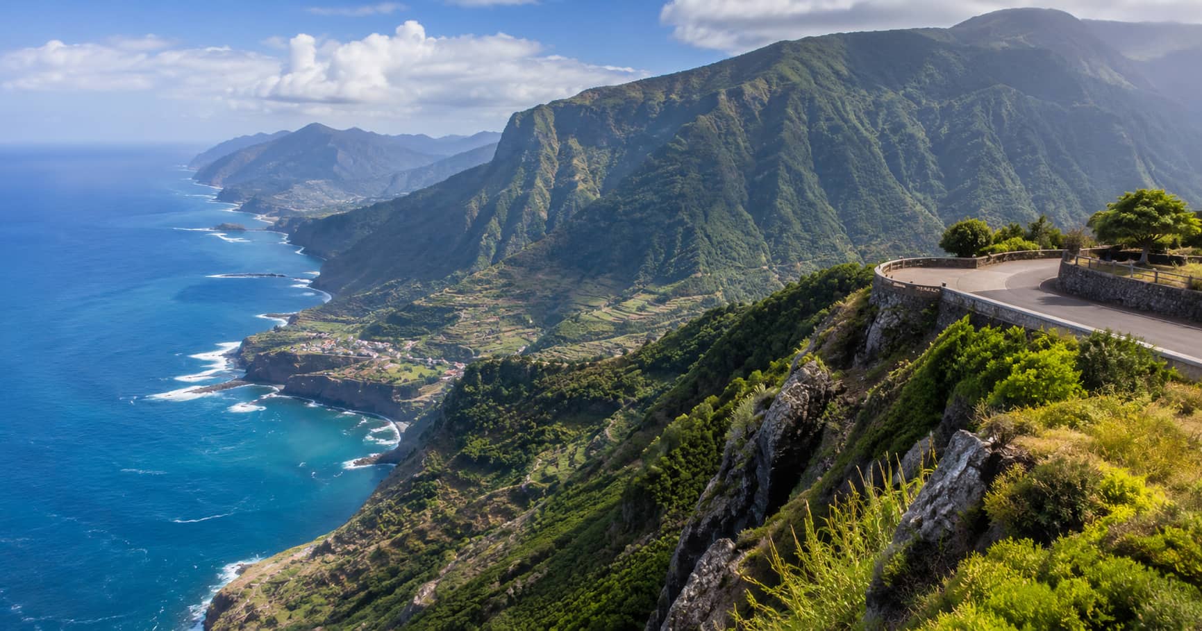
Madeira Viewpoints Road Trip
A flexible Madeira road trip linking coastal overlooks, mountain viewpoints, forest stops, and short walks while accounting for changing island weather.
A flexible Madeira road trip linking coastal overlooks, mountain viewpoints, forest stops, and short walks while accounting for changing island weather.
Madeira has more marked viewpoints than most travelers can use well in one visit. Mountain roads climb from sea level into cloud, coastal cliffs face different directions, and local weather can separate one side of the island from another within the same hour. The right road-trip strategy is therefore flexible: choose a strong sunrise or morning target, keep several lower alternatives, and avoid crossing the island repeatedly for a view that may remain hidden.
Madeira’s viewpoints fall into three useful groups. High mountain locations such as Pico do Areeiro depend on cloud level, wind, and visibility. Coastal cliffs such as Cabo Girão and Ponta do Rosto are exposed to wind but may remain clear when the central peaks are covered. Lower town and valley viewpoints, including those above Funchal and Câmara de Lobos, provide reliable visual options in mixed weather.
The official Madeira tourism site maintains a broad directory of island viewpoints. Use it to identify regional backups, then check live weather and road information before driving. A saved list is more useful than one rigid sequence.
Pico do Areeiro stands at 1,818 metres and is one of Madeira’s highest accessible points. The official visitor page describes views over the central mountain massif, Ponta de São Lourenço, Curral das Freiras, and, in clear conditions, Porto Santo. It is popular partly because road access reaches close to the viewpoint. That convenience should not be confused with predictable conditions.
Cloud can hide the mountains completely, while strong wind can make exposed areas uncomfortable or unsafe. Check webcams and the mountain forecast before leaving. If visibility is poor, do not wait indefinitely in the car park or start a high trail hoping conditions will improve. The famous PR1 route toward Pico Ruivo is a mountain hike, not an extension of a roadside photo stop, and current trail closures must be respected.
Sunrise above cloud can be impressive, but arriving before dawn requires careful driving on dark mountain roads. Do not stop outside marked areas, walk along unlit roads, or stand near exposed edges for a cleaner composition. Bring warm layers because the temperature and wind at altitude can differ sharply from Funchal. If cloud covers the summit, switch to an eastern coastal viewpoint instead of spending the whole morning waiting.
Ponta do Rosto sits on the São Lourenço Peninsula, where the terrain becomes drier, more open, and less forested than much of Madeira. The official tourism description notes that both the north and south coasts can be seen from this location. That makes it one of the island’s clearest orientation stops.
Morning light often suits the east, but the exposed peninsula can be windy. Keep away from unstable cliff edges and use established viewing areas. The layered headlands produce stronger images when some foreground is included; a completely empty sea horizon does not explain the geological shape of the peninsula.
Cabo Girão rises around 580 metres above the south coast and includes a glass skywalk. It is easy to reach and heavily visited. The view downward toward cultivated fajãs and across Câmara de Lobos is visually different from a mountain panorama, so it deserves a place in the route. However, the platform is compact and is not a good location for a long tripod setup when busy.
Arrive early or treat it as a short midday stop. Look beyond the glass floor and use the coastline, fields, and settlement pattern to show scale. If the platform is crowded, nearby south-coast viewpoints can provide calmer angles without repeating the exact same vertical view.
Pico da Torre sits at about 205 metres and offers a broad view over Câmara de Lobos, its bay, and parts of Funchal. Unlike the dramatic cliff stops, this viewpoint helps explain how the town fits into the surrounding slopes. The harbor below gives a clear subject, while roads and houses create useful layers.
Visit the waterfront as well as the high point. A road-trip guide should not remain above every place it visits. The lower harbor view adds boats, working space, and street context, while the viewpoint gives orientation. Together they create a more complete visual record than either stop alone.
Castelo do Pico and Pico Alto are useful backups near the capital. Castelo do Pico gives a structured urban view over Funchal Bay from a historic fortification. Pico Alto, higher in Funchal’s Ecological Park, opens a wider view over the city and Atlantic when visibility allows. Because they sit closer to services and accommodation, they are easier to use when the main mountain plan fails.
This flexible approach follows the same principle as the Dolomites road-trip plan: protect the most weather-dependent stop, but do not let one summit control the whole day.
For an eastern day, combine Pico do Areeiro only if clear, then move to Portela, Machico, and Ponta do Rosto. For a western and south-coast day, use Câmara de Lobos, Cabo Girão, and selected viewpoints toward Ribeira Brava or Ponta do Sol. The north deserves its own route because tunnels and mountain roads make repeated crossings slower than they look.
Fuel the car before leaving the main towns, download maps, and allow time for roadwork or weather-related closures. Do not follow navigation apps blindly onto narrow local roads simply because they appear shorter.
Madeira rewards travelers who make decisions on the morning of the trip. High cloud may remove Pico do Areeiro but improve light on the coast. Wind may make an exposed cliff unpleasant while a sheltered valley remains clear. Rain can create atmosphere in Funchal even when distant panoramas disappear.
Choose one high viewpoint, one coast, one town overview, and one lower backup. That mix gives the day visual range and reduces unnecessary driving. The island’s best road trip is not the one that reaches the most miradouros. It is the one that responds intelligently to elevation, exposure, and weather.